Deskripsi
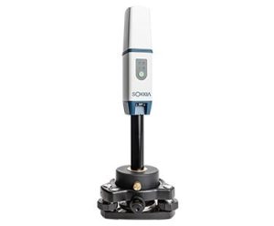
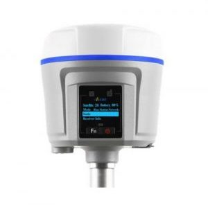
GPS GEODETIC GNSS-RTK SOKKIA-GCX-3
Global Positioning System (GPS) is a system for determining the position on the earth’s surface with the help of satellite signal synchronization. This system uses 24 satellites that send microwave signals to Earth. Systems similar to GPS include Russian GLONASS, European Union Galileo, India’s IRNSS.
GCX3 adalah sistem lokasi / rover RTK (Real Time Kinematic) jobsite lokal ideal atau rover Network RTK. Dan seperti semua produk kami, Anda dapat menyesuaikannya untuk memenuhi kebutuhan Anda dan membuat alur kerja Anda sendiri.
Penerima GNSS konstelasi All-in-view
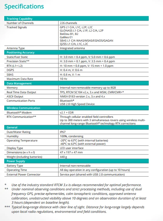
226 saluran pelacakan satelit yang dioptimalkan
Desain yang ringkas, ringan, kokoh, dan bebas kabel
RTK rover jaringan yang ideal
Nirkabel, teknologi multi-channel Long-Range Bluetooth®
GPS GEODETIC GNSS-RTK SOKKIA-GCX-3
Kineta Survey Jakarta is one of the businesses engaged in the sale of survey and mapping tools for Jakarta, which is located at Jl. Raya Petojo Binatu III No. 28 Kineta Jakarta, as a center for surveying and mapping tools, provides complete products such as Total Station, Digital Theodolite, GPS, Compass, Automatic Level Waterpass and others.
Kineta Survey Jakarta is the center of excellent service for survey instruments by providing quality products and official guarantees. Entrust your needs for survey and mapping tools only at Kineta Survey Jakarta.

 Contac :

Ulasan
Belum ada ulasan.