Deskripsi
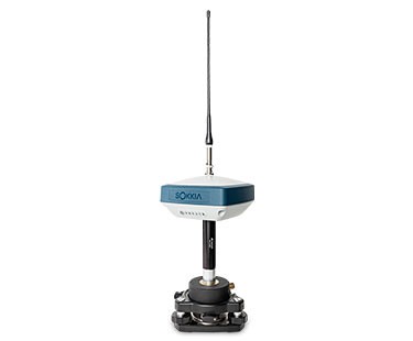
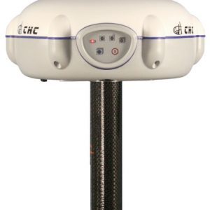
GPS GEODETIC SOKKIA GRX3
Global Positioning System (GPS) is a system for determining the position on the earth’s surface with the help of satellite signal synchronization. This system uses 24 satellites that send microwave signals to Earth. This signal is received by the receiver on the surface, and is used to determine the location, speed, direction, and time. Systems similar to GPS include Russian GLONASS, European Union Galileo, India’s IRNSS.
Exceptional Versatility in a compact design
The Sokkia GRX3 is smaller, lighter, and packed with the most advanced GNSS technology in a design built to withstand the harshest field environments. All signals, all satellites and all constellations — in a compact, rugged design, with an integrated IMU and eCompass.
GPS GEODETIC SOKKIA GRX3 Sokkia Tilt Technology
Incorporates a revolutionary 9-axis inertial measurement unit (IMU) and ultra-compact eCompass, which compensate for mis-leveling up to 15 degrees.
- Sokkia Tilt Technology
- L Band Ready Technology
- 226 Universal Tracking Channels (GPS, GLONASS, Galileo, BeiDou, IRNSS, QZSS, SBAS)
- Integrated 400 MHz UHF and SiteCom™ radios
- Fusion Positioning™ technology
Kineta Survey Jakarta is one of the businesses engaged in the sale of survey and mapping tools for Jakarta, which is located at Jl. Raya Petojo Binatu III No. 28 Kineta Jakarta, as a center for surveying and mapping tools, provides complete products such as Total Station, Digital Theodolite, GPS, Compass, Automatic Level Waterpass and others.
Kineta Survey Jakarta is the center of excellent service for survey instruments by providing quality products and official guarantees. Entrust your needs for survey and mapping tools only at Kineta Survey Jakarta.


Ulasan
Belum ada ulasan.