Deskripsi
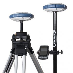
GPS GEODETIC SPECTRA SP60
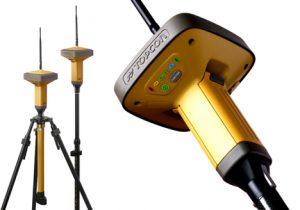
Global Positioning System (GPS) GPS GEODETIC SPECTRA SP60 is a system for determining the position on the earth’s surface with the help of satellite signal synchronization. This system uses 24 satellites that send microwave signals to Earth. This signal is received by the receiver on the surface, and is used to determine the location, speed, direction, and time. Systems similar to GPS include Russian GLONASS, European Union Galileo, India’s IRNSS.
GPS GEODETIC SPECTRA SP60
Combining the unique all-signals-tracking and processing Z-Blade GNSS-centric technology and L-band capability for satellite-delivered RTX service, the SP60 receiver provides the most reliable measurements and the highest possible accuracy under any conditions and in any place the world.
Extremely scalable and versatile, SP60 can respond to any type of surveying job, starting with a simple L1 GPS only post-processing solution up to dual-frequency GNSS network RTK rover.SP60 integrates powerful Long Range Bluetooth capabilities opening new operation modes to surveyors.
Now, the Bluetooth wireless communication can be used as an alternative radio link between base and rover for a few hundred meters range making this solution very attractive for small site surveys.
Easier and simpler than UHF radio, and without any need for a license this can be a very efficient way to quickly setup a short range base rover solution.
The patented UHF antenna, set inside the fiberglass rod, extends the range of RTK radio performance and provides protection at the same time. All these enhancements make the design of SP60 GNSS receiver unique and powerful.
Spectra Precision Survey Pro or FAST Survey field software provides an easy-to use, yet powerful GNSS workflow, letting the surveyor concentrate on getting the job done.
Spectra Precision Survey Office Software provides a complete office suite for data processing and Spectra Precision Central cloud computing solution offers a simple to use pathway to data exchange and management.
Moreover, combined with the most advanced and rugged field data collectors from Spectra Precision, SP60 is a very powerful and complete solution.
Includes:
SP60 L1 GPS Receiver (L-Band, SBAS, L1 GPS)
PN 92600-10 – Battery – Li-Ion, 2.6Ah, 7.4V 19.2 Wh
PN 53018010-SPN – Charger – Dual Li-Ion Battery Charger
PN 78651-SPN – Power Cord Kit with C7 Connector
PN 78650-SPN – Power Supply,65W,19V,3.42A,100-240VAC
PN 93374 – Tape Measure, 3.6m / 12ft
PN 88400-50-SPN – Extension Pole 7cm
PN 67901-11 – Cable USB Client to Host
206490-ASH – Field System Bag
Product Software and Documentation Leaflet
SP60 Quick Start Guide
Anti-Theft Technology Sticker
Spectra Precision Survey Office Basic Software
1 year manufacturer’s warranty
Kineta Survey Jakarta is one of the businesses engaged in the sale of survey and mapping tools for Jakarta, which is located at Jl. Raya Petojo Binatu III No. 28 Kineta Jakarta, as a center for surveying and mapping tools, provides complete products such as Total Station, Digital Theodolite, GPS, Compass, Automatic Level Waterpass and others.
Kineta Survey Jakarta is the center of excellent service for survey instruments by providing quality products and official guarantees. Entrust your needs for survey and mapping tools only at Kineta Survey Jakarta


Ulasan
Belum ada ulasan.