Deskripsi
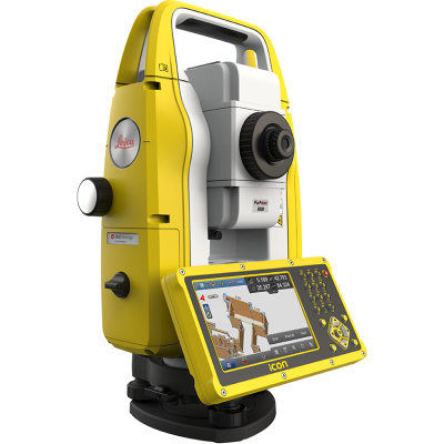
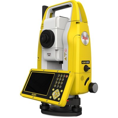
TOTAL STATION LEICA iCON-iCB50
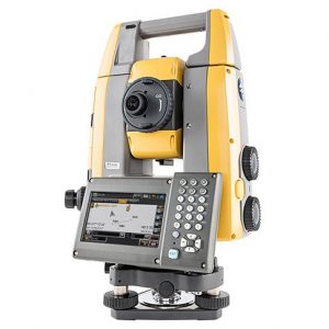
TOTAL STATION LEICA iCON-iCB50 A total station is an optical / electronic instrument used in mapping and building construction. The total station is an integrated theodolite with an electronic distance meter (EDM) component to read the distance and slope from the instrument to a certain point.
Total stations are widely used in land mapping, such as topographic maps for road and building construction. Total stations are also used at archaeological sites to measure the depth of excavations, and by the police to conduct crime scenes.
The total stations used in the construction sector are generally used to measure the construction site before leveling the ground and laying the foundation, as well as measuring the desired level of slope and leveling of the floor as well as certain building methods against other buildings. In addition, installation of piping and cables also requires this technology; especially piping to improve fluid pumping efficiency.
Start Your Digital Construction Journey Here! Take the first step from error-prone analogue layout methods to modern, accurate digital techniques.
Package includes the Leica iCB50 Construction Total Station, on-board Leica iCON Build Software, Tripod and training from our expert team.
Let our construction team show you how to set out directly from BIM Models and integrate controller data with Autodesk BIM360 & Procore.
TOTAL STATION LEICA iCON-iCB50
Leica Geosystems’ new manual construction total station, the Leica iCON iCB50, simplifies your first step from conventional analogue layout methods to modern digital techniques which are needed for modern BIM processes.
Easy-to-use and designed specifically for applications in the building construction industry, the Leica iCON iCB50 requires minimal training making you ready quicker for the no-tapes and no-strings approach to construction layout.
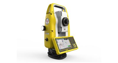
TOTAL STATION LEICA iCON-iCB50
Leica iCON iCB50 Key Benefits :
- Layout points and lines quickly and accurately
- Layout complex structures easily
- Quickly perform verticality checks on formwork and structures
- Complete fast and accurate as-built measurements
- Work with digital design data including fully rendered models in IFC format
- Working directly with digital design data on board of the instrument allows the operator to prepare and execute construction tasks faster, simpler and more accurately.
- Benefit from simplified stakeout and as-built tasks on the construction project and the ability to react quicker to changes and updates in the design.
Leica iCON iCB50 Features:
- Leica iCON build on-board software
- 5″ colour touch screen and full numeric keyboard
- FineFocus telescope to simply aim to a defined target
- 2’’ and 5’’ angular accuracy
- Reflectorless measurements
- Bluetooth
- IP66 rating
Go digital
Take the no-tapes and no-strings approach to construction measurements. Swap from conventional analogue measurement methods to modern digital layout techniques. Be more efficient by moving away from error prone and time-consuming layout methods using tapes and strings.
Increase productivity
Conventional manual construction layout methods with tools such as tapes and strings, plumb-bobs, levels or rulers are time-consuming and prone to error. In cases of design changes the effort is even doubled. Moving from modern digital layout methods with the iCON manual construction total stations will save you time, money and increase safety on site.
Ease-of-use
Leica iCON manual construction total stations are simple to learn and easy to master. With minimal training the whole workforce is more efficient and benefits from digital construction workflows, helping to complete projects on time and under budget.
Leica iCON field
The tailored construction software Leica iCON runs on the complete iCON product family from Leica Geosystems. Benefit from the intuitive user interface of Leica iCON on manual and robotic total stations, GNSS antennas and controllers.


Ulasan
Belum ada ulasan.